
Location
A tropical oasis struggling to survive
As the second largest national park in Honduras, Pico Bonito National Park is an abundant forest of primitive beauty. With picturesque sceneries and exotic plant and animal species, the Park is a sanctuary of organic beauty and wildlife.
However, due to ever-growing economic pressures and the resulting continued decline of natural resources, the communities of Pico Bonito face rising rural poverty while endangered species suffer increased pressures toward possible extinction.
Project Location
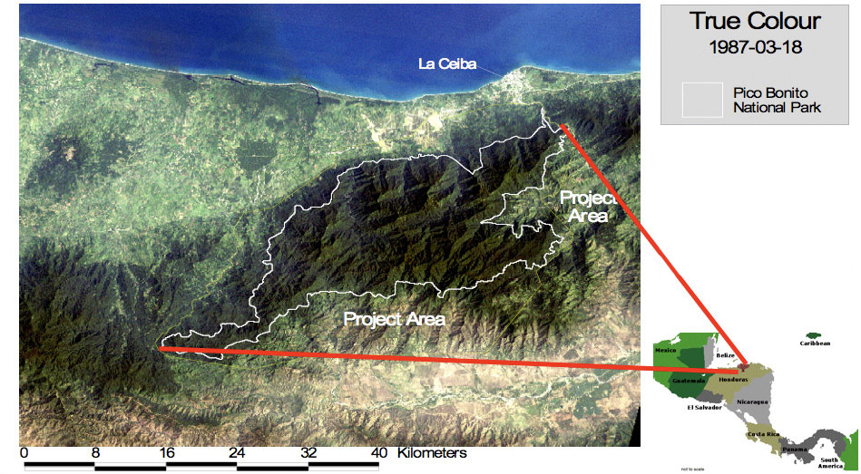
Pico Bonito National Park is the second largest national park in Honduras. It is located approximately 20 kilometers from La Ceiba – the country’s third largest city located on the north coast of the country. The Park consists of a core which is fully protected national lands, and a buffer zone which is only partially protected private owned lands.
Bosques Pico Bonito is located in and around the buffer zone of Pico Bonito National Park. Although classified as an environmentally sensitive area in need of protection, certain uses of land within the buffer zone are permitted, including the use for which this venture has been created.
Pico Bonito National Park Location Facts
- 19 Main Watersheds
- 9 Mountains
- 24,000 People From 82 Communities
- 107,000 hectares (265,000 acres), [yellow line] Buffer zone, [red circles]

Click to enlarge
Project Area
Click to enlarge